


One ground station for the whole fleet
AirCruise flashes, configures, calibrates, plans and flies MAVLink vehicles from one desktop application, from a single aircraft to a swarm of dozens.
- Windows
- Linux
- macOS
- Android
- iOS
- Linux Server
- Oculus VR
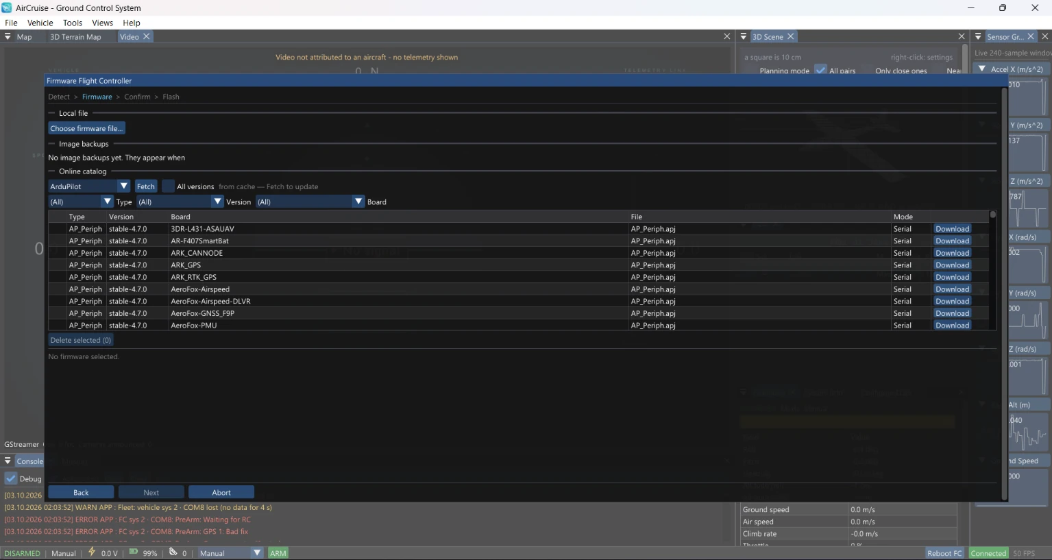
Firmware in four steps
Detect, Firmware, Confirm, Flash: one guided flow takes a flight controller from an unknown state to a known build.
- Online ArduPilot catalog, filtered by type, version and board
- Local firmware files for your own builds
- Image backups listed next to the catalog
Every vehicle setting in one window
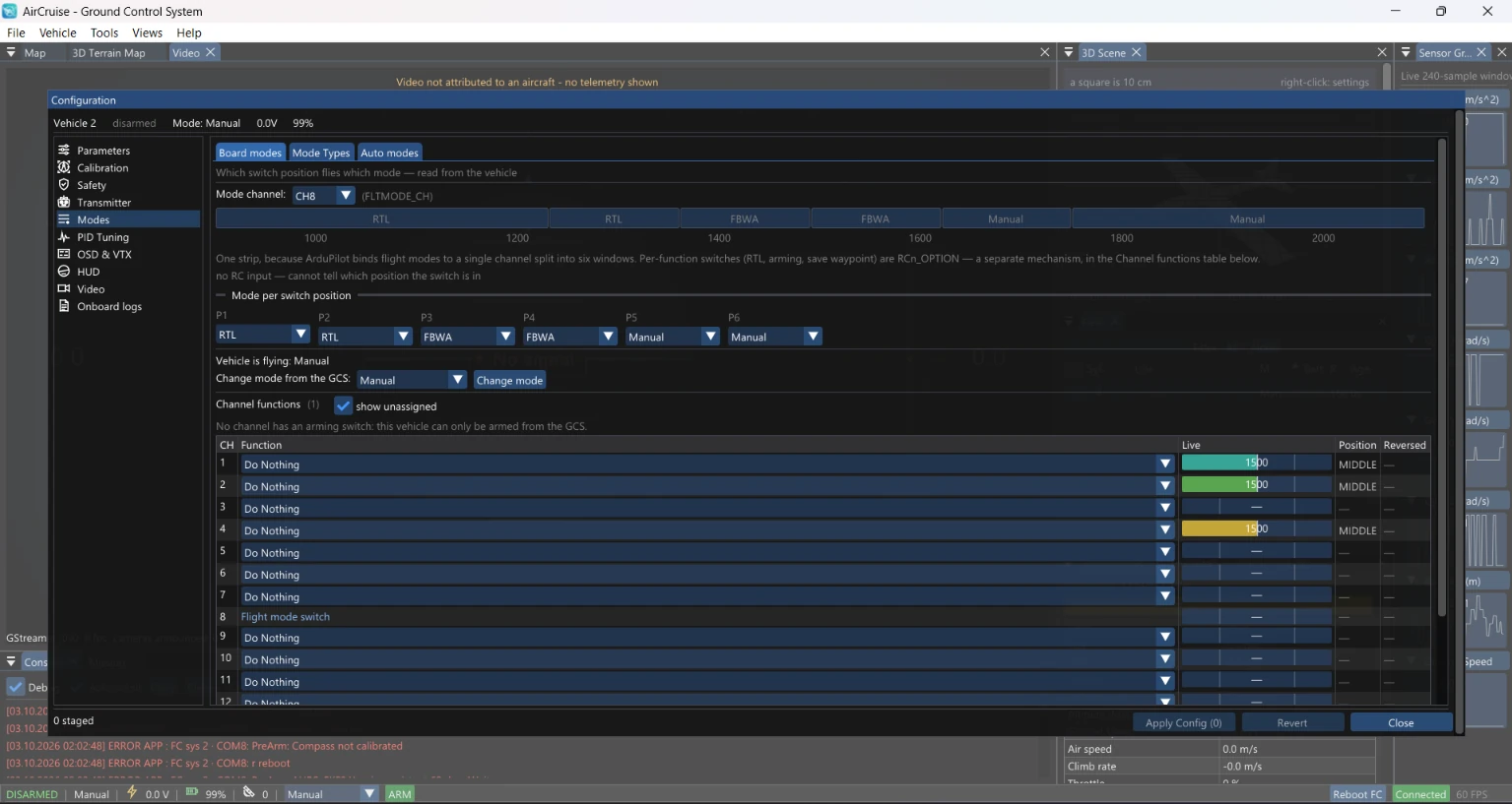
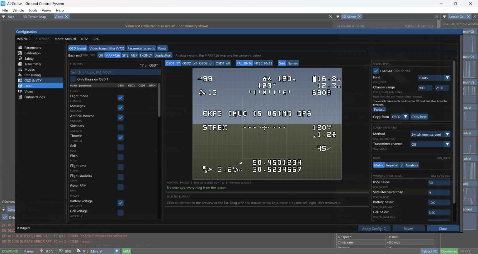
Parameters, safety, transmitter, flight modes, OSD and VTX, HUD, video and onboard logs share one configuration window. Edits are staged first, then applied or reverted together.
- Flight mode per switch position, drawn on the PWM strip
- Channel functions next to live channel values
- OSD layout editor: drag elements on a preview, with an overlap check
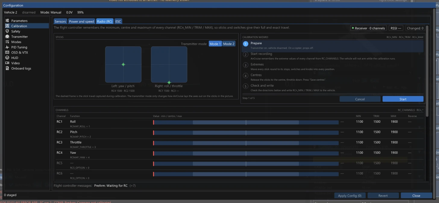
Calibration that shows what to do
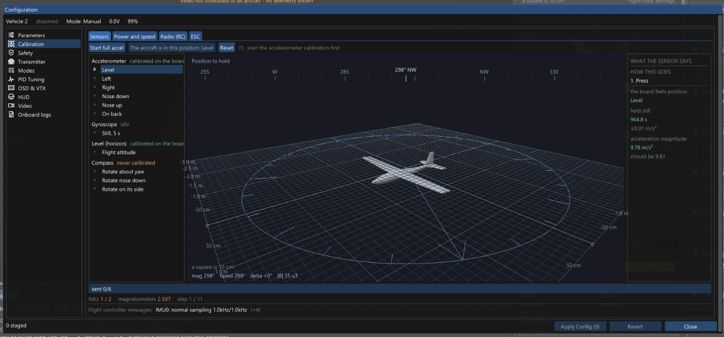
Each step names the position to hold and shows it on a 3D model of the vehicle, while a side panel reports what the sensor is measuring right now.
- Accelerometer, gyroscope, level and compass
- Radio wizard that records minimum, centre and maximum of every channel
- Power, speed and ESC calibration in the same place
Draw the area, get the mission
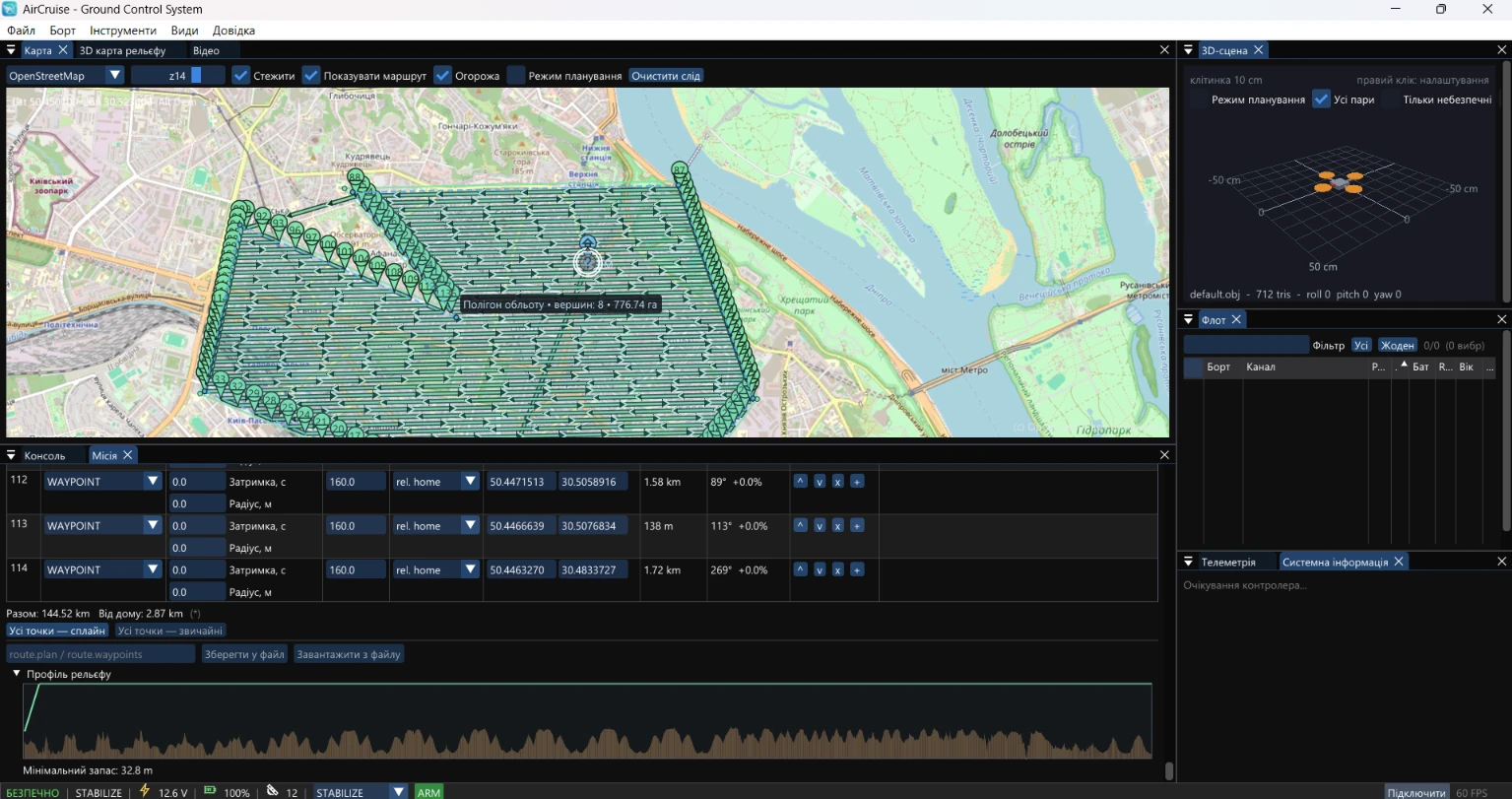
Outline a polygon on the map and AirCruise lays out the survey grid, builds a fence around it and checks the route against the terrain.
- Survey grid generated from the polygon
- Inclusion fence created from the survey area
- Terrain profile with the minimum clearance along the route
- Spline or straight waypoints, saved as route.plan or route.waypoints
Fly over real terrain
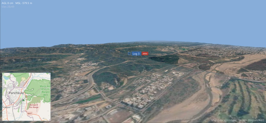
The 3D terrain map drapes satellite imagery over an elevation mesh and places every vehicle above it, from one aircraft to a whole swarm.
- Satellite imagery on a terrain mesh, with AGL and MSL readout
- Follow, HD, wireframe and a locator mini-map
- Vertical exaggeration and a radio-link overlay (k = 4/3)
- The same view for live vehicles and for log replay
Live video with a flight HUD on top
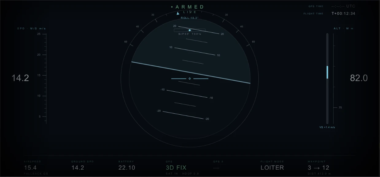
The video tab puts attitude, speed, altitude, battery, GPS state, flight mode and waypoint progress over the camera feed.
- GStreamer video input
- Telemetry appears only when the video is attributed to an aircraft
- 2D map and 3D terrain map in the neighbouring tabs
Tune with the spectrum in front of you
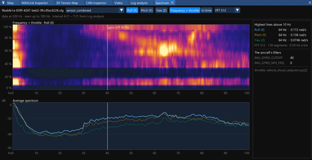
PID tuning has its own section in the vehicle configuration. The Spectrum tab shows what the gyro actually sees, so filters and gains are set from data.
- Frequency × throttle heatmap for roll, pitch and yaw
- Average spectrum and the highest lines above 10 Hz
- The aircraft's own filter settings marked on the plot
- A ready Roll PID plot set in log analysis
Replay a flight and read its data
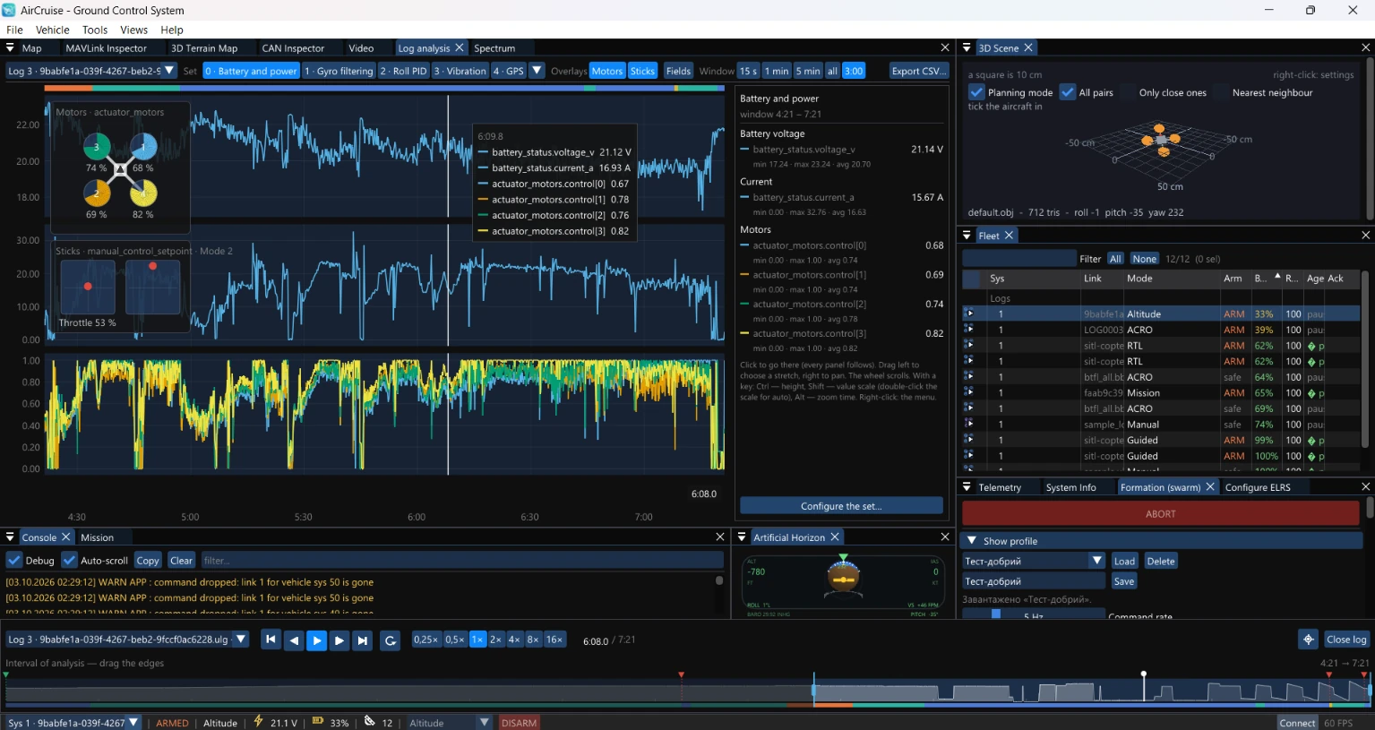
Open a log and it becomes a vehicle in the fleet: it flies again on the map, on the 3D terrain and on the horizon, while the plots follow the same cursor.
- Ready plot sets: battery and power, gyro filtering, roll PID, vibration, GPS
- Motor and stick overlays, with minimum, maximum and average for the chosen window
- Playback from 0.25× to 16×, with an analysis interval dragged on the timeline
- Several logs open at once, .ulg and .bbl among them, and export to CSV
- Live sensor graphs for connected vehicles
Design the formation before it flies
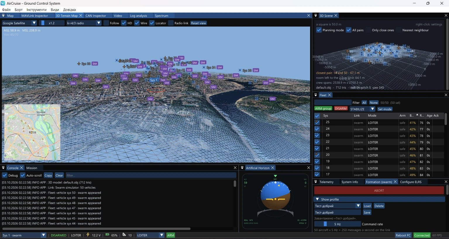
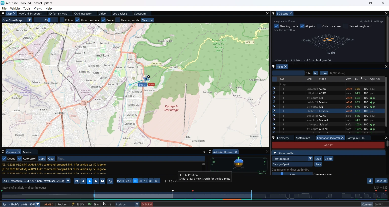
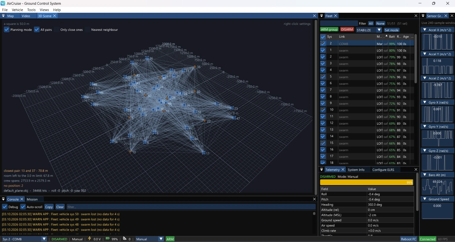
The 3D scene places every vehicle, draws the distance between pairs and reports the closest pair and the room left to the separation limit.
- Planning mode with all pairs, only close ones or the nearest neighbour
- Closest pair, room to the limit and the span of the whole group
- Group ARM, DISARM and mode change from the fleet list
- Saved formation profiles, with the command rate budgeted against the link
Control, telemetry and video, relayed onward
AirCruise can pass all three links of a vehicle on to another endpoint, not only terminate them at the operator's screen.
Links: Control, Telemetry, Video
Step into the airspace
In an Oculus headset the 3D map surrounds you: terrain out to the horizon and every vehicle in the air around you. Point at one, select it and take control.
Interactive illustration · move the pointer to look around, click a vehicle
The same fleet on a phone
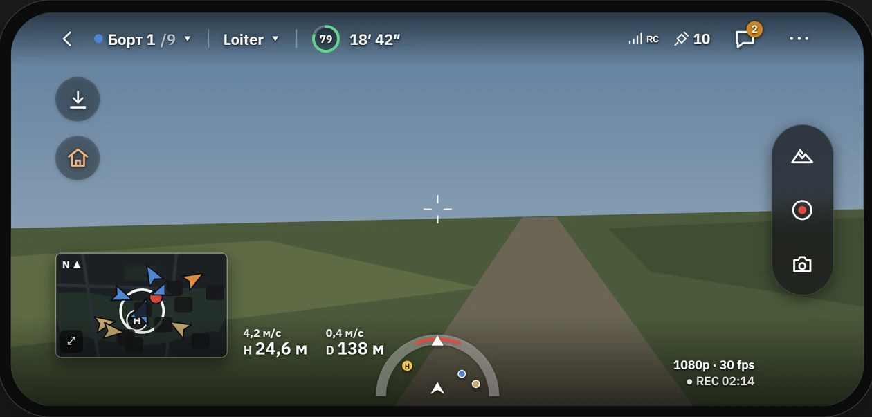
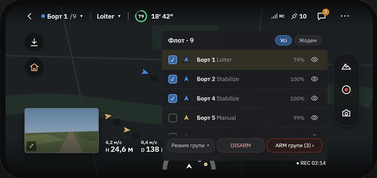
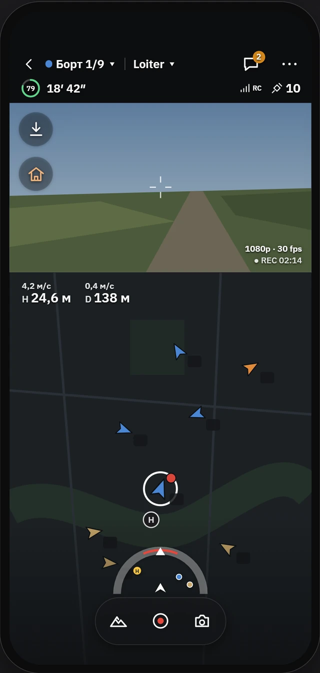
A touch layout puts the video full screen with the map in a corner, flight modes as tiles and the fleet one tap away.
- Mode tiles: takeoff, Loiter, RTL, Land and more
- Fleet panel with group ARM and DISARM
- Landscape and portrait layouts
Android · iOS
Built for the field desk
- Windows
- Linux
- macOS
- Android
- iOS
- Linux Server
- Oculus
See AirCruise with your own vehicles
Tell us what you fly and how many. We will show the workflow from firmware to a flying group on a call or on site.